-45%   PROMOTION

Papiers peints: Sikkim map. highlight sikkim map on india map with a boundary

Papiers peints Sikkim map. Highlight Sikkim map on India map with a boundary line. India details map.
Papiers peints:
Sikkim map. Highlight Sikkim map on India map with a boundary line. India details map..
Auteur: ©
Numéro de l'image:
#253379864
Autres sujets:
vecteur, Voyage, tourisme visite, territoire, Etat, vignetage, silhouette, gribouiller, région
Visualisation du produit
Similaire
Madhya Pradesh Map. Political and administrative map of Madhya Pradesh with districts name. Showing International and State boundary and district boundary of Madhya Pradesh. Vector  of districts map.
Ladakh map District map of Ladakh. Ladakh map with district and capital. Colour full district map of Ladakh.
Jammu and Kashmir map. District map of Jammu and Kashmir in 2020. District map of Jammu and Kashmir in color with capital.
Tamil nadu map. District ways map of tamil nadu with name. Vector illustration of Tamilnadu geographical map. New and original design with showing border line and name.
Nagaland map. District map of Nagaland. Nagaland map with district and capital. Colour full district map of Nagaland.
Sikkim map. Highlight Sikkim map on India map with a boundary line. Sikkim political map.
Jharkhand map. Showing State boundary and district boundary of Jharkhand. Political and administrative colorful map of Jharkhand with districts name.
West Bengal map. Showing district boundary of Punjab. Vector illustration of districts map of West Bengal. Colorful map.
vector illustration of Odisha map
Punjab map. International and State boundary and district boundary of Punjab. Vector illustration of districts map.
Tamil nadu map. District ways map of tamil nadu with name. Vector illustration of Tamilnadu geographical map. New and original design with showing border line and name.
Rajasthan map. Political and administrative map of Rajasthan with districts name. Showing International and State boundary and district boundary of Rajasthan. Vector illustration of districts map.
administrative, area, asia, background, bay, bengal, border, capital, cartography, chennai, city, contour, country, detailed, districts, division, geography, graphic, grey, icon, illustration, india,
California Map. State and district map of California. Administrative and political map of California with neighboring countries and border in white color.
California map. Political map of California in Outline. District map with USA.
California Map. State and district map of California. Administrative and political map of California with the major district
California Map. State and district map of California. Administrative and political map of California with names and color design.
California map. California District map in white color. District map with USA.
California map. California District map in Outline. District map with USA.
California Map. State and district map of California. Administrative and political map of California with neighboring countries and borders.
Karnataka full map. vector illustration of colourful district map of karnataka
Kerala district map in colorful design vector illustration.
Alabama Map. State and district map of Alabama. Administrative and political map of Alabama with outline and black and white design.
Alabama Map. State and district map of Alabama. Administrative and political map of Alabama with neighboring countries and borders.
Alabama Map. State and district map of Alabama. Administrative and political map of Alabama with neighboring countries and border in white color.
Political map of Alabama with boudaries in Outline.
Alabama Map. State and district map of Alabama. Administrative and political map of Alabama with major district
Alabama map. District map of Alabama in 2020. District map of Alabama in colour with capital.
Alabama Map. State and district map of Alabama. Administrative and political map of Alabama with district and capital in white color.
California map. Political map of California in Outline. District map with USA.
California Map. State and district map of California. Administrative and political map of California with the major district
California Map. State and district map of California. Administrative and political map of California with names and color design.
California map. California District map in white color. District map with USA.
California map. California District map in Outline. District map with USA.
California Map. State and district map of California. Administrative and political map of California with neighboring countries and borders.
California Map. State and district map of California. Administrative and political map of California with neighboring countries and border in white color.
Alabama Map. State and district map of Alabama. Administrative and political map of Alabama with neighboring countries and borders.
Alabama Map. State and district map of Alabama. Administrative and political map of Alabama with neighboring countries and border in white color.
Political map of Alabama with boudaries in Outline.
Alabama Map. State and district map of Alabama. Administrative and political map of Alabama with major district
Alabama map. District map of Alabama in 2020. District map of Alabama in colour with capital.
Alabama Map. State and district map of Alabama. Administrative and political map of Alabama with district and capital in white color.
Alabama Map. State and district map of Alabama. Administrative and political map of Alabama with outline and black and white design.
Jharkhand map. Jharkhand districts map with name labels. Jharkhand hilited in India map with white background.
Maharashtra map with outline colour. Maharashtra map without colour. Maharashtra map 2019. all districts in Maharashtra.
Arkansas Map. State and district map of Arkansas. Administrative and political map of Arkansas with district and capital in white color.
Political map of Arkansas. Highlight Arkansas map on India map with a boundary line. Arkansas political map..
Arkansas Map. State and district map of Arkansas. Administrative and political map of Arkansas with names and color design.
Arkansas District map in Outline.
Political map of Arkansas in white color.
Political map of Arkansas in Outline.
District map of Arizona in Outline.
Political map of Arizona. Arizona Map. State and district map of Arizona. Administrative and political map of Arizona with neighboring countries and borders.
Political map of Arizona in white color.
Political map of Arizona in Outline.
Arizona Map. State and district map of Arizona. Administrative and political map of Arizona with the major district.
administrative, area, asia, background, bay, bengal, border, capital, cartography, chennai, city, contour, country, detailed, districts, division, geography, graphic, grey, icon, illustration, india,
India map. States and union territories of India. India political map with capital New Delhi, national borders, important cities, rivers and lakes. English labeling and scaling with details.
Arizona map. District map of Arizona.
Arizona map. District map of Arizona in white color.
Political map of Arkansas in white color.
Arkansas District map in Outline.
Arkansas Map. State and district map of Arkansas. Administrative and political map of Arkansas with names and color design.
Arkansas Map. State and district map of Arkansas. Administrative and political map of Arkansas with district and capital in white color.
Arkansas Map. State and district map of Arkansas. Administrative and political map of Arkansas with the major district.
Political map of Arkansas in Outline.
Political map of Arkansas. Highlight Arkansas map on India map with a boundary line. Arkansas political map..
Political map of Arizona in Outline.
Political map of Arizona. Arizona Map. State and district map of Arizona. Administrative and political map of Arizona with neighboring countries and borders.
Political map of Arizona in white color.
Arizona Map. State and district map of Arizona. Administrative and political map of Arizona with the major district.
Arizona map. District map of Arizona.
Arizona map. District map of Arizona in white color.
District map of Arizona in Outline.
Haryana map. Haryana administrative and political map. Haryana map with neighboring countries and borders.
West Bengal map. Political and administrative map of West Bengal with districts name. Showing International and State boundary and district boundary of Assam. Illustration of districts Kolkata map.
West Bengal map. West Bengal districts map with name labels. White background. Showing International and State boundary and district boundary of West Bengal. Vector Illustration of districts  map.
West Bengal map. Showing International and State boundary and district boundary of West Bengal. Political and administrative map of West Bengal with districts name in gray color.
Punjab map. Political and administrative map of Punjab with districts name. Showing International and State boundary and district boundary of Punjab. Vector illustration of districts map.
voir plusgarder
Matériaux

Papier peint vinyle

Le papier peint vinyle est imprimé sur un support résistant à la une surface lisse et mate.

La technologie HP Latex utilisée vous fera profiter de couleurs intenses au fil du temps.

  • ✓ Résistant à la déformation et à l'étirement
  • ✓ Perméable à la vapeur d'eau
  • ✓ Facile à poser
  • ✓ Encre HP Latex écologique

Largeur maximale des lés de papier peint : 95-105 cm. Pour les dimensions supérieures à la largeur du matériau, les impressions seront réalisées sur plusieurs lés égaux
Utilisation : murs lisses et plats
Collage: bord à bord. La colle ne s’applique que sur la surface de vos murs ce qui réduit le risque d'endommagement de votre papier peint et permet également de petites corrections afin d’ajuster la pose
Nettoyage : chiffon sec
Finition : semi-mate


Papier peint vinyle lavable

Le papier peint vinyle lavable est imprimé sur un support résistant à la une surface lisse et mate. Il est également stratifié ce qui le protège de l’humidité et autres facteurs extérieurs (éraflure, égratignure, exposition au soleil).

La technologie HP Latex utilisée vous fera profiter de couleurs intenses au fil du temps.

  • ✓ Stratifié
  • ✓ Résistant à l’humidité, aux éraflures, égratignures et à l’exposition au soleil
  • ✓ Résistant à la déformation et à l'étirement
  • ✓ Perméable à la vapeur d'eau
  • ✓ Facile à poser
  • ✓ Encre HP Latex écologique

Largeur maximale des lés de papier peint: 95-105 cm. Pour les dimensions supérieures à la largeur du matériau, les impressions seront réalisées sur plusieurs lés égaux
Utilisation : murs lisses et plats. Pièces avec une forte présence d’humidité (cuisine, salle de bains) ou celles dont les surfaces seraient susceptibles d’être éraflées (couloir, chambre d’enfant, hôtel, restaurant, salle de conférence, bâtiment public, école, maternelle, crèche)
Collage: bord à bord. La colle ne s’applique que sur la surface de vos murs ce qui réduit le risque d'endommagement de votre papier peint et permet également de petites corrections afin d’ajuster la pose
Nettoyage: chiffon humide
Finition: semi-mate
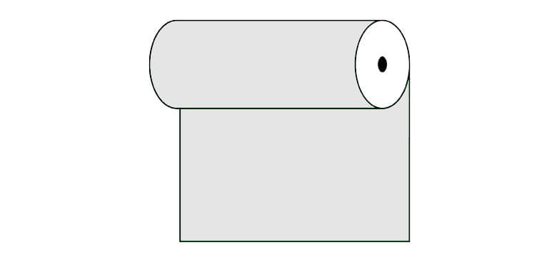

Papier peint vinyle expansé

Le papier peint vinyle est imprimé sur un support résistant à la structure « sable fin » ce qui intensifie le rendu de profondeur de l’impression. La technologie HP Latex utilisée vous fera profiter de couleurs intenses au fil du temps.

  • ✓ Structure sable fin
  • ✓ Résistant à la déformation et à l'étirement
  • ✓ Perméable à la vapeur d'eau
  • ✓ Facile à poser
  • ✓ Encre HP Latex écologique

Largeur maximale des lés de papier peint: 100cm. Pour les dimensions supérieures à la largeur du matériau, les impressions seront réalisées sur plusieurs lés égaux
Utilisation : murs lisses et plats. Le papier peint photo conviendra aussi bien dans des intérieurs comme la maison mais aussi dans un restaurant, une l’école ou encore au travail dans les bureaux
Collage: bord à bord. La colle ne s’applique que sur la surface de vos murs ce qui réduit le risque d'endommagement de votre papier peint et permet également de petites corrections afin d’ajuster la pose
Nettoyage: chiffon sec
Finition: semi-mate, structure sable fin


Papier peint vinyle expansé lavable

Le papier peint vinyle est imprimé sur un support résistant à la structure «sable fin» ce qui intensifie le rendu de profondeur de l’impression. La technologie HP Latex utilisée vous fera profiter de couleurs intenses au fil du temps.

  • ✓ Stratifié
  • ✓ Structure sable fin
  • ✓ Résistant à l’humidité, aux éraflures, égratignures et à l’exposition au soleil
  • ✓ Résistant à la déformation et à l'étirement
  • ✓ Perméable à la vapeur d'eau
  • ✓ Facile à poser
  • ✓ Encre HP Latex écologique

Largeur maximale des lés de papier peint: 100cm. Pour les dimensions supérieures à la largeur du matériau, les impressions seront réalisées sur plusieurs lés égaux
Utilisation : murs lisses et plats. Pièces avec une forte présence d’humidité (cuisine, salle de bains) ou celles dont les surfaces seraient susceptibles d’être éraflées (couloir, chambre d’enfant, hôtel, restaurant, salle de conférence, bâtiment public, école, maternelle, crèche)
Collage: bord à bord. La colle ne s’applique que sur la surface de vos murs ce qui réduit le risque d'endommagement de votre papier peint et permet également de petites corrections afin d’ajuster la pose
Nettoyage: chiffon humide
Finition: semi-mate, structure sable fin


Papier peint autocollant

Ce papier peint conviendra à différents types de pièces et de surfaces. Les papiers peints autocollants pourront décorer vos murs, vos armoires, vos vitres, vos meubles et autres surfaces lisses. La technologie HP Latex utilisée vous fera profiter de couleurs intenses au fil du temps.

  • ✓ Pas besoin de colle
  • ✓ Très facile à poser
  • ✓ Résistant à la déformation et à l'étirement
  • ✓ Perméable à la vapeur d'eau
  • ✓ Encre HP Latex écologique

Largeur maximale des lés de papier peint: 133cm. Pour les dimensions supérieures à la largeur du matériau, les impressions seront réalisées sur plusieurs lés égaux
Utilisation : surfaces lisses, utilisation universelle
Collage: bord à bord
Nettoyage: chiffon humide
Finition: semi-mate


voir plusgarder
Voir aussi
vector illustration of pouring water in bucket
vector illustration of water pouring the bucket and dropping outside the bucket
vector illustration of cute puppy
vector illustration of Orissa map with border
vector illustration of Telangana district map with borders
vector illustration of Odisha map
vector illustration of Jammu Kashmir and Ladakh new map in 2019
vector illustration of cute puppy
vector illustration of Jammu Kashmir and Ladakh new map with state and cities  name
vector illustration of Jammu Kashmir and Ladakh new map with state,cities and capital name
Vector illustration of wastage of water goes unchecked
vector illustration of Orissa map with border
vector illustration of Telangana district map with borders
vector illustration of Uttar Pradesh map with border
vector illustration of Telangana map
vector illustration of Jammu Kashmir and Ladakh new map in 2019
vector illustration of Uttar Pradesh map with district
vector illustration of Jammu Kashmir and Ladakh new map with state name
vector illustration of Jammu Kashmir and Ladakh new map with state and capital name
vector illustration of Jammu Kashmir and Ladakh new map with state,cities and capital name
vector illustration of India new map in 2019 with states and cities name
vector illustration of Jammu Kashmir and Ladakh new map with state and capital name
vector illustration of Uttar Pradesh district map
vector illustration of India new map with new States division in 2019
vector illustration of India new map in 2019 with States cities and capital name
vector illustration of India new map with new States division in 2019
vector illustration of India old map with states
vector illustration of Telangana map in India
vector illustration of Telangana map outline
vector illustration of Uttar Pradesh map with district
vector illustration of Telangana map
vector illustration of Telangana map outline
vector illustration of Telangana map in India
vector illustration of Jammu Kashmir and Ladakh new map with state name
vector illustration of Odisha map
vector illustration of Jammu Kashmir and Ladakh new map with state and capital name
vector illustration of India new map in 2019 with states and cities name
vector illustration of Uttar Pradesh map
vector illustration of Uttar Pradesh district map
vector illustration of water pouring the bucket and dropping outside the bucket
vector illustration of water crisis
vector illustration of save water concept
vector illustration of water crisis
vector illustration of save water save life concept
vector illustration of save water. water saving is most important for our future.
vector illustration of save water. water conservation is most important for life
vector illustration of save water concept
vector illustration of save water. water conservation is most important for life
vector illustration of save water save life concept
vector illustration of save water. water saving is most important for our future.
vector illustration of cute puppy sitting on mat
vector illustration of India new map in 2019
vector illustration of India new map in 2019 with states and cities name
vector illustration of India old map with states
Vector illustration of wastage of water goes unchecked
vector illustration of simple balance with fruits concept
vector illustration of pouring water in bucket
vector illustration of water overflowing from bucket
vector illustration of old woman carrying water
vector illustration of simple balance with fruits concept
vector illustration of water drum
Vector illustration of Assam in India map
vector illustration of water wastage from damage bucket
vector illustration of India map of physical division
Vector illustration of wastage of water
vector illustration of Meghalaya in India map
Vector illustration of Arunachal Pradesh in India map
vector illustration of subtractions in animal theme
vector illustration of animal map of India
wastage of water
water wastage from damage bucket
vector illustration of water purification
Arunachal Pradesh in India map
vector illustration of Punjab in India map
vector illustration of India and neighboring country map
India and neighboring country map
Meghalaya in India map
voir plusgarder

Notre boutique en ligne utilise des cookies et des technologies connexes. Grâce à eux, nous assurons une qualité de service optimale et garantissons le bon fonctionnement du site web. Une fois votre consentement obtenu, les cookies seront également utilisés pour des mesures supplémentaires et l'analyse de l'utilisation du site. Cela nous permettra d'adapter le site à vos intérêts et de vous présenter un contenu et une publicité personnalisés.
Vos données sont gérées par Fairbox Sp. z o.o. et, dans certaines situations, par nos partenaires avec lesquels nous coopérons. Pour des informations détaillées sur l'utilisation des cookies et le traitement de vos données personnelles, veuillez consulter notre Politique en matière de confidentialité et de cookies.
Paramètres des cookies
Vous trouverez ci-dessous les descriptions des différentes catégories de cookies et la possibilité de les personnaliser selon vos préférences:
Les cookies indispensables
Nous les utilisons pour assurer le bon fonctionnement du site web. Ils vous permettent de naviguer dans notre boutique sans interruption et d'effectuer vos achats en toute sécurité.
Les cookies fonctionnels
Ils sont utilisés pour mémoriser les choix que vous faites sur le site, ce qui permet d'adapter le site à vos préférences personnelles et d'améliorer votre expérience en tant qu'utilisateur.
Les cookies analytiques
Les cookies analytiques mesurent le nombre de visites et collectent des informations sur les sources de trafic du site. Ils nous permettent de comprendre comment les utilisateurs se servent du site, d'améliorer la qualité du service et d'adapter le contenu de la boutique pour mieux répondre aux besoins de nos clients.
Les cookies marketing
Les cookies marketing nous permettent, ainsi qu'à nos partenaires, d'adapter le contenu publicitaire à vos centres d'intérêt. Ils sont également utilisés pour afficher des publicités sur d'autres sites web.