-45%   PROMOTION

Papiers peints: Moldova map showing country highlighted in green color with rest

Papiers peints Moldova map showing country highlighted in green color with rest of European countries in brown
Papiers peints:
Moldova map showing country highlighted in green color with rest of European countries in brown.
Auteur: ©
Numéro de l'image:
#276726664
Autres sujets:
europa, Roumanie, Moldavie, à trois dimensions, papier, grunge, Voyage, contour, Résumé
Visualisation du produit
Similaire
The World map Relief Bathymetry oceans in blue
World map with countries classified by population density
topografische Weltkarte mit hellblauen Ozeanen
Africa relief map
Egypt map with cities streets rivers lakes
Geographische physische Karte von Slowakei
Physical map of North Carolina with mountains, plains, bridges, rivers, lakes, mountains, cities
Vektor Administrative Gliederung Österreich Bundesland  Burgenland Gemeinde Karte
Karte Administrative Gliederung Bundesland Niederösterreich Statutarstadt, Bezirk Österreichkarte
South Korea physical map with important rivers the capital and big cities
South America Map with its countries and regions Geographic Coordinates latitude and longitude German language
Asia map in green with yellow outline
Physical map of the country of Algeria
Switzerland  Vector Map Showing Country highlighted in White with Black Outline
Karten von Vereinigtes Königreich  ClipArt Farbe und schwarz-weiß Karte
Karten von Ungarn ClipArt Farbe und schwarz-weiß Karte
Karten von Ukraine ClipArt Farbe und schwarz-weiß Karte
Karten von Tschechien ClipArt Farbe und schwarz-weiß Karte
Karten von Spanien ClipArt Farbe und schwarz-weiß Karte
Karten von Slowenien ClipArt Farbe und schwarz-weiß Karte
Karten von Republik Moldau ClipArt Farbe und schwarz-weiß Karte
Karten von Österreich ClipArt Farbe und schwarz-weiß Karte
Karten von Niederlande  ClipArt Farbe und schwarz-weiß Karte
Karten von Montenegro ClipArt Farbe und schwarz-weiß Karte
Karten von Luxemburg ClipArt Farbe und schwarz-weiß Karte
Israel map Borders, capital Jerusalem neighboring countries
Israel map Borders, capital Jerusalem White background
Europe map of average annual temperatures
Asia map of average annual temperatures
South America map of average annual temperatures
Africa map of average annual temperatures
North America map of average annual temperatures
World map of average annual temperatures
North America map with countries classified by population density
South America map with countries classified by population density
Europe map with countries classified by population density
Africa map with countries classified by population density
Asia map with countries classified by population density
World map with countries classified by area
South America map with countries classified by area
North America map with countries classified by area
Europe map with countries classified by area
Asia map with countries classified by area
Africa map with countries classified by area
The South America map classified by the number of inhabitants of the countries and with the abbreviation of the countries
The Asia map classified by the number of inhabitants of the countries and with the abbreviation of the countries
The Africa map classified by the number of inhabitants of the countries and with the abbreviation of the countries
The North America map classified by the number of inhabitants of the countries and with the abbreviation of the countries
The world map classified by the number of inhabitants of the countries
The Europe map classified by the number of inhabitants of the countries and with the abbreviation of the countries
Physical map of Wisconsin with mountains, plains, bridges, rivers, lakes, mountains, cities
Physical map of South Carolina with mountains, plains, bridges, rivers, lakes, mountains, cities
Physical map of New Jersey with mountains, plains, bridges, rivers, lakes, mountains, cities
Physical map of Indiana with mountains, plains, bridges, rivers, lakes, mountains, cities
Physical map of Illinois with mountains, plains, bridges, rivers, lakes, mountains, cities
Physical map of Florida with mountains, plains, bridges, rivers, lakes, mountains, cities
Physical map of Arizona with mountains, plains, bridges, rivers, lakes, mountains, cities
Karte Administrative Gliederung Bundesland Wien Statutarstadt, Bezirk Österreichkarte
Geographische physische Karte von Tschechien
Geographische physische Karte von Slowenien
Geographische physische Karte von Portugal
Geographische physische Karte von Niederlande
Geographische physische Karte von Irland
Geographische physische Karte von Estland
Geographische physische Karte von Belgien
Karte Administrative Gliederung Bundesland Vorarlberg Statutarstadt, Bezirk Österreichkarte
Karte Administrative Gliederung Bundesland Tirol Statutarstadt, Bezirk Österreichkarte
Karte Administrative Gliederung Bundesland Steiermark Statutarstadt, Bezirk Österreichkarte
Karte Administrative Gliederung Bundesland Oberösterreich Statutarstadt, Bezirk Österreichkarte
Karte Administrative Gliederung Bundesland Burgenland Statutarstadt, Bezirk Österreichkarte
Zimbabwe vintage map
South Africa vintage map
Nigeria vintage map
Niger vintage map
Algeria vintage map
Vector map of France with subregions in green country name in red
Vector map of Spain with subregions in green country name in red
Map of the united states of america shading
Vector map of Australia with subregions in green country name in red
voir plusgarder
Matériaux

Papier peint vinyle

Le papier peint vinyle est imprimé sur un support résistant à la une surface lisse et mate.

La technologie HP Latex utilisée vous fera profiter de couleurs intenses au fil du temps.

  • ✓ Résistant à la déformation et à l'étirement
  • ✓ Perméable à la vapeur d'eau
  • ✓ Facile à poser
  • ✓ Encre HP Latex écologique

Largeur maximale des lés de papier peint : 95-105 cm. Pour les dimensions supérieures à la largeur du matériau, les impressions seront réalisées sur plusieurs lés égaux
Utilisation : murs lisses et plats
Collage: bord à bord. La colle ne s’applique que sur la surface de vos murs ce qui réduit le risque d'endommagement de votre papier peint et permet également de petites corrections afin d’ajuster la pose
Nettoyage : chiffon sec
Finition : semi-mate


Papier peint vinyle lavable

Le papier peint vinyle lavable est imprimé sur un support résistant à la une surface lisse et mate. Il est également stratifié ce qui le protège de l’humidité et autres facteurs extérieurs (éraflure, égratignure, exposition au soleil).

La technologie HP Latex utilisée vous fera profiter de couleurs intenses au fil du temps.

  • ✓ Stratifié
  • ✓ Résistant à l’humidité, aux éraflures, égratignures et à l’exposition au soleil
  • ✓ Résistant à la déformation et à l'étirement
  • ✓ Perméable à la vapeur d'eau
  • ✓ Facile à poser
  • ✓ Encre HP Latex écologique

Largeur maximale des lés de papier peint: 95-105 cm. Pour les dimensions supérieures à la largeur du matériau, les impressions seront réalisées sur plusieurs lés égaux
Utilisation : murs lisses et plats. Pièces avec une forte présence d’humidité (cuisine, salle de bains) ou celles dont les surfaces seraient susceptibles d’être éraflées (couloir, chambre d’enfant, hôtel, restaurant, salle de conférence, bâtiment public, école, maternelle, crèche)
Collage: bord à bord. La colle ne s’applique que sur la surface de vos murs ce qui réduit le risque d'endommagement de votre papier peint et permet également de petites corrections afin d’ajuster la pose
Nettoyage: chiffon humide
Finition: semi-mate
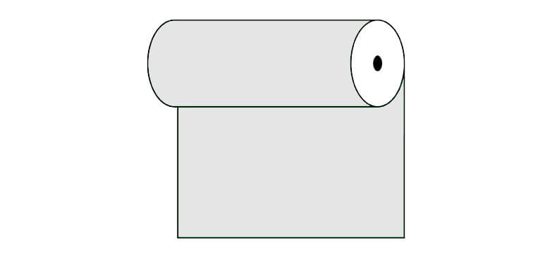

Papier peint vinyle expansé

Le papier peint vinyle est imprimé sur un support résistant à la structure « sable fin » ce qui intensifie le rendu de profondeur de l’impression. La technologie HP Latex utilisée vous fera profiter de couleurs intenses au fil du temps.

  • ✓ Structure sable fin
  • ✓ Résistant à la déformation et à l'étirement
  • ✓ Perméable à la vapeur d'eau
  • ✓ Facile à poser
  • ✓ Encre HP Latex écologique

Largeur maximale des lés de papier peint: 100cm. Pour les dimensions supérieures à la largeur du matériau, les impressions seront réalisées sur plusieurs lés égaux
Utilisation : murs lisses et plats. Le papier peint photo conviendra aussi bien dans des intérieurs comme la maison mais aussi dans un restaurant, une l’école ou encore au travail dans les bureaux
Collage: bord à bord. La colle ne s’applique que sur la surface de vos murs ce qui réduit le risque d'endommagement de votre papier peint et permet également de petites corrections afin d’ajuster la pose
Nettoyage: chiffon sec
Finition: semi-mate, structure sable fin


Papier peint vinyle expansé lavable

Le papier peint vinyle est imprimé sur un support résistant à la structure «sable fin» ce qui intensifie le rendu de profondeur de l’impression. La technologie HP Latex utilisée vous fera profiter de couleurs intenses au fil du temps.

  • ✓ Stratifié
  • ✓ Structure sable fin
  • ✓ Résistant à l’humidité, aux éraflures, égratignures et à l’exposition au soleil
  • ✓ Résistant à la déformation et à l'étirement
  • ✓ Perméable à la vapeur d'eau
  • ✓ Facile à poser
  • ✓ Encre HP Latex écologique

Largeur maximale des lés de papier peint: 100cm. Pour les dimensions supérieures à la largeur du matériau, les impressions seront réalisées sur plusieurs lés égaux
Utilisation : murs lisses et plats. Pièces avec une forte présence d’humidité (cuisine, salle de bains) ou celles dont les surfaces seraient susceptibles d’être éraflées (couloir, chambre d’enfant, hôtel, restaurant, salle de conférence, bâtiment public, école, maternelle, crèche)
Collage: bord à bord. La colle ne s’applique que sur la surface de vos murs ce qui réduit le risque d'endommagement de votre papier peint et permet également de petites corrections afin d’ajuster la pose
Nettoyage: chiffon humide
Finition: semi-mate, structure sable fin


Papier peint autocollant

Ce papier peint conviendra à différents types de pièces et de surfaces. Les papiers peints autocollants pourront décorer vos murs, vos armoires, vos vitres, vos meubles et autres surfaces lisses. La technologie HP Latex utilisée vous fera profiter de couleurs intenses au fil du temps.

  • ✓ Pas besoin de colle
  • ✓ Très facile à poser
  • ✓ Résistant à la déformation et à l'étirement
  • ✓ Perméable à la vapeur d'eau
  • ✓ Encre HP Latex écologique

Largeur maximale des lés de papier peint: 133cm. Pour les dimensions supérieures à la largeur du matériau, les impressions seront réalisées sur plusieurs lés égaux
Utilisation : surfaces lisses, utilisation universelle
Collage: bord à bord
Nettoyage: chiffon humide
Finition: semi-mate


voir plusgarder
Voir aussi
Cyprus map showing country highlighted in green color with rest of European countries in brown
Colombia map showing country highlighted in green color with rest of South America countries in brown
Iraq map showing country highlighted in green color with rest of on the Persian Gulf countries in brown
An black and white Topographic map lines 100 m labeling, level curves, contour, terrain path, travel background. Geographic abstract grid. Vector illustration
Albania map showing country highlighted in green color with rest of European countries in brown
Egypt map showing country highlighted in green color with rest of African countries in brown
Costa Rica map showing country highlighted in green color with rest of central America countries in brown
Angola map showing country highlighted in green color with rest of African countries in brown
Ecuador map showing country highlighted in green color with rest of African countries in brown
Guinea-Bissau map showing country highlighted in green color with rest of African countries in brown
Iran map showing country highlighted in green color with rest of on the Persian Gulf countries in brown
Kuwait map showing country highlighted in green color with rest of Asian countries in brown
Democratic Republic of the Congo map showing country highlighted in green color with rest of African countries in brown
Chad map showing country highlighted in green color with rest of African countries in brown
India map showing country highlighted in green color with rest of Asian countries in brown
An green and white Topographic map lines 25 m, level curves, contour, terrain path, travel background. Geographic abstract grid. Vector illustration
Israel map showing country highlighted in green color with rest of Asian countries in brown
An black and white Topographic map lines 100 m, level curves, contour, terrain path, travel background. Geographic abstract grid. Vector illustration
Guyana map showing country highlighted in green color with rest of African countries in brown
Hungary map showing country highlighted in green color with rest of European countries in brown
An black and white Topographic map lines 25 m, level curves, contour, terrain path, travel background. Geographic abstract grid. Vector illustration
Bangladesh map showing country highlighted in green color with rest of Asian countries in brown
An green and black Topographic map lines 100 m, level curves, contour, terrain path, travel background. Geographic abstract grid. Vector illustration
Macedonia map showing country highlighted in green color with rest of European countries in brown
Georgia map showing country highlighted in green color with rest of European and Asian countries in brown
Greenland (Denmark) map showing country highlighted in green color with rest of European countries in brown
Honduras map showing country highlighted in green color with rest of central America countries in brown
An green and white Topographic map lines 50 m, level curves, contour, terrain path, travel background. Geographic abstract grid. Vector illustration
An black and white Topographic map lines 100 m, level curves, contour, terrain path, travel background. Geographic abstract grid. Vector illustration
Latvia map showing country highlighted in green color with rest of European countries in brown
Czech Republic map showing country highlighted in green color with rest of European countries in brown
Brunei map showing country highlighted in green color with rest of Asian countries in brown
An black and white Topographic map lines 100 m labeling, level curves, contour, terrain path, travel background. Geographic abstract grid. Vector illustration
Liechtenstein map showing country highlighted in green color with rest of European countries in brown
Belarus map showing country highlighted in green color with rest of European countries in brown
Bahamas map showing country highlighted in green color with rest of caribbeans island and Atlantic Ocean in blue
City map of Berlin in white with illustrative silhouette of the Friedrichshain - Kreuzberg district in gray
Belize
Greece Greenland (Denmark) map showing country highlighted in green color with rest of European countries in brown
Cape Verde map showing country highlighted in green color with rest of Ocean in blue
Antigua and Barbuda map showing country highlighted in green color with rest of Ocean in blue
Color Topographic map lines, level curves, contour, terrain, background. Geographic abstract grid.
Ireland map showing country highlighted in green color with rest of European countries in brown
Ghana map showing country highlighted in green color with rest of African countries in brown
Fiji map showing country highlighted in green color with rest of Ocean in blue
Maldives map showing country highlighted in green color with rest of Ocean in blue
Japan map showing country highlighted in green color with rest of Asian countries in brown and Ocean in blue
America Samoa map showing country highlighted in green color with rest of South Pacific Ocean in blue
Cambodia map showing country highlighted in green color with rest of Asian countries in brown
Gambia map showing country highlighted in green color with rest of African countries in brown
Romania map showing country highlighted in green color with rest of European countries in brown
map of the world
France map showing country highlighted in green color with rest of European countries in brown
Lesotho map showing country highlighted in green color with rest of African countries in brown
Lebanon map showing country highlighted in green color with rest of Asian countries in brown
Laos map showing country highlighted in green color with rest of Asian countries in brown
Kyrgyzstan map showing country highlighted in green color with rest of Asian countries in brown
Kenya map showing country highlighted in green color with rest of African countries in brown
Kazakhstan map showing country highlighted in green color with rest of Asian countries in brown
Bahrain map showing country highlighted in green color with rest of Asian countries in brown
Jordan map showing country highlighted in green color with rest of Asian countries in brown
Malaysia map showing country highlighted in green color with rest of Asian countries in brown
Malawi map showing country highlighted in green color with rest of African countries in brown
Madagascar map showing country highlighted in green color with rest of African countries in brown
Luxembourg map showing country highlighted in green color with rest of European countries in brown
Lithuania map showing country highlighted in green color with rest of European countries in brown
map of continent
with rest of Ocean in blue
Iceland map showing country highlighted in green color with rest of Ocean in blue
map showing country highlighted in green color with rest of Asian countries in brown
Italy map showing country highlighted in green color with rest of European countries in brown
Ivory Coast map showing country highlighted in green color with rest of African countries in brown
Jamaica map showing country highlighted in green color with rest of central America countries in brown
Finland map showing country highlighted in green color with rest of European countries in brown
Gabon map showing country highlighted in green color with rest of African countries in brown
Gibraltar map showing country highlighted in green color with rest of European countries in brown
Guatemala map showing country highlighted in green color with rest of central America countries in brown
Guinea map showing country highlighted in green color with rest of African countries in brown
Djibouti map showing country highlighted in green color with rest of African countries in brown
voir plusgarder

Notre boutique en ligne utilise des cookies et des technologies connexes. Grâce à eux, nous assurons une qualité de service optimale et garantissons le bon fonctionnement du site web. Une fois votre consentement obtenu, les cookies seront également utilisés pour des mesures supplémentaires et l'analyse de l'utilisation du site. Cela nous permettra d'adapter le site à vos intérêts et de vous présenter un contenu et une publicité personnalisés.
Vos données sont gérées par Fairbox Sp. z o.o. et, dans certaines situations, par nos partenaires avec lesquels nous coopérons. Pour des informations détaillées sur l'utilisation des cookies et le traitement de vos données personnelles, veuillez consulter notre Politique en matière de confidentialité et de cookies.
Paramètres des cookies
Vous trouverez ci-dessous les descriptions des différentes catégories de cookies et la possibilité de les personnaliser selon vos préférences:
Les cookies indispensables
Nous les utilisons pour assurer le bon fonctionnement du site web. Ils vous permettent de naviguer dans notre boutique sans interruption et d'effectuer vos achats en toute sécurité.
Les cookies fonctionnels
Ils sont utilisés pour mémoriser les choix que vous faites sur le site, ce qui permet d'adapter le site à vos préférences personnelles et d'améliorer votre expérience en tant qu'utilisateur.
Les cookies analytiques
Les cookies analytiques mesurent le nombre de visites et collectent des informations sur les sources de trafic du site. Ils nous permettent de comprendre comment les utilisateurs se servent du site, d'améliorer la qualité du service et d'adapter le contenu de la boutique pour mieux répondre aux besoins de nos clients.
Les cookies marketing
Les cookies marketing nous permettent, ainsi qu'à nos partenaires, d'adapter le contenu publicitaire à vos centres d'intérêt. Ils sont également utilisés pour afficher des publicités sur d'autres sites web.