 PLN
PLN BRL
BRL CZK
CZK EUR
EUR EUR
EUR EUR
EUR EUR
EUR GBP
GBP RUB
RUB SEK
SEK USD
USD

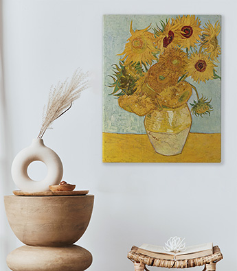


Image sur toile
Nos images sont imprimées sur des toiles CANVAS de haute qualité montées sur de solides châssis en pin. Les bords des toiles sont imprimés. Une fois déballée, l’image est prête à être installée sur le mur.
- ✓ Toile artistique
- ✓ Haute qualité
- ✓ Châssis intérieur en pin
Grammage de la toile: 300 g/m2
Configurations disponibles: standard ou en plusieurs parties avec 2, 3,4 ou 5 éléments
Nettoyage : le matériau peut être essuyé avec un chiffon humide
Composition de l’ensemble : image (toile imprimée et montée sur le châssis), fixations et clous

Image encadrée
Nos images sont imprimées sur des toiles CANVAS de haute qualité montées sur de solides châssis en pin. Les bords des toiles sont imprimés. Une fois déballée, l’image est prête à être installée sur le mur. Dans cette version, l’image est ornée d’un cadre extérieur disponible en marron ou en noir. Ces cadres sont disponibles dans des dimensions définies. A réception, l’image est prête à être installée sur le mur.
- ✓ Toile artistique CANVAS
- ✓ Bords imprimés
- ✓ Châssis intérieur en pin
Grammage de la toile: 300 g/m2
Suppléments disponibles : cadre extérieur en bois disponible en deux couleurs, marron ou noir. Ces cadres existent pour des dimensions définies
Nettoyage: le matériau peut être délicatement nettoyé avec un chiffon humide
Composition de l’ensemble : image (toile imprimée et montée sur le châssis), cadre en bois extérieur, fixations et clous

Image sur toile en deux parties
Nos images sont imprimées sur des toiles CANVAS de haute qualité montées sur de solides châssis en pin. Une fois déballée, l’image est prête à être installée sur le mur.
- ✓ Deux Parties
- ✓ Toile artistique CANVAS
- ✓ Bords imprimés
- ✓ Châssis intérieur en pin
Grammage de la toile: 300 g/m2
Nettoyage: le matériau peut être essuyé avec un chiffon humide
Composition de l’ensemble : image (toile imprimée et montée sur le châssis), fixations et clous

Image sur toile en trois parties
Nos images sont imprimées sur des toiles CANVAS de haute qualité montées sur de solides châssis en pin. Une fois déballée, l’image est prête à être installée sur le mur.
- ✓ Trois Parties
- ✓ Toile artistique CANVAS
- ✓ Bords imprimés
- ✓ Châssis intérieur en pin
Grammage de la toile: 300 g/m2
Nettoyage: le matériau peut être essuyé avec un chiffon humide
Composition de l’ensemble : image (toile imprimée et montée sur le châssis), fixations et clous

Image sur toile en quatre parties
Nos images sont imprimées sur des toiles CANVAS de haute qualité montées sur de solides châssis en pin. Une fois déballée, l’image est prête à être installée sur le mur.
- ✓ Quatre Parties
- ✓ Toile artistique CANVAS
- ✓ Bords imprimés
- ✓ Châssis intérieur en pin
Grammage de la toile: 300 g/m2
Nettoyage: le matériau peut être essuyé avec un chiffon humide
Composition de l’ensemble : image (toile imprimée et montée sur le châssis), fixations et clous

Image sur toile en cinq parties
Nos images sont imprimées sur des toiles CANVAS de haute qualité montées sur de solides châssis en pin. Une fois déballée, l’image est prête à être installée sur le mur.
- ✓ Cinq Parties
- ✓ Toile artistique CANVAS
- ✓ Bords imprimés
- ✓ Châssis intérieur en pin
Grammage de la toile: 300 g/m2
Nettoyage: le matériau peut être essuyé avec un chiffon humide
Composition de l’ensemble : image (toile imprimée et montée sur le châssis), fixations et clous


